Damavand Maps
Helpful info for Ascending Mount Damavand South Route.
- Related Topics
- Google Earth
- GPS Landmarks
Damavand Road and Route Maps
In this topic you will find helpful and interesting Damavand Mountain Iran road and route maps. These maps shows you all the ways and footpaths of the mountain, from Tehran to starting points, from camps to the peak, you will learn how to go to the summit of Iran and Middle East by your own. You can Download or view the full size images in jpg format.Read more in What is Mount Damavand known for?
Some original full size images are avalable free of cahrge, interested mountaineering groups and individual climbers may send their request with the title Mt Damavand Map in the email subject. Visit also Damavand Maps Q&A.

Download and View The Original Size Image
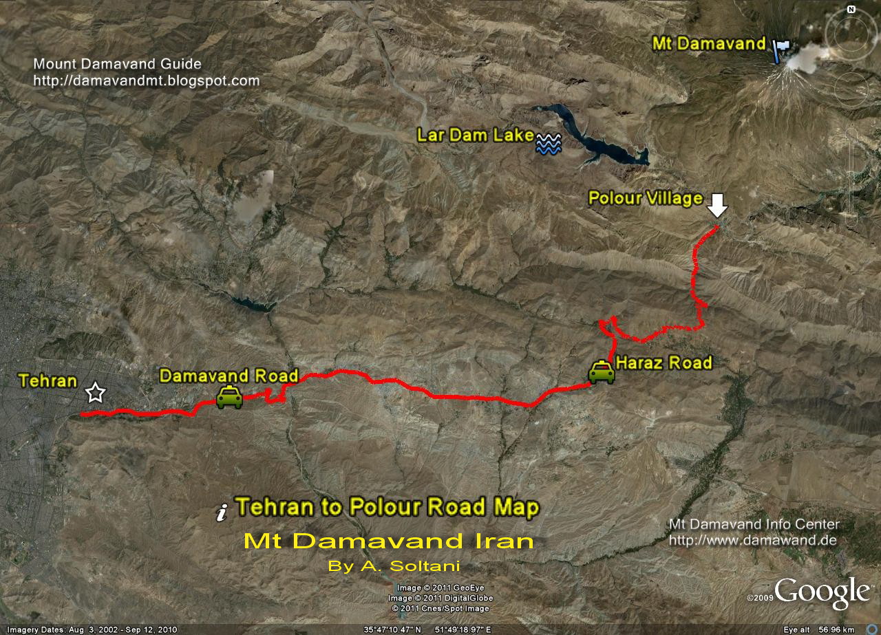
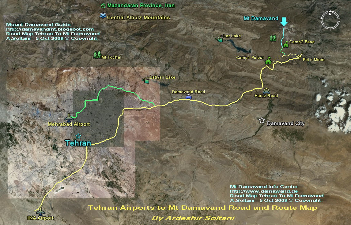
Mt Damavand Iran Road and Route Map
By Ardeshir Soltani, Guide Mount Damavand Iran
Tehran to Camp1 Polour

Download and View The Original Size Image
Tehran To Polour Village Road Map
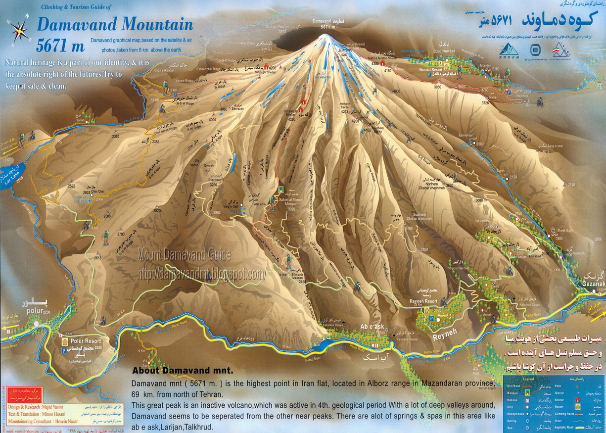
Climbing Mount Damavand Iran
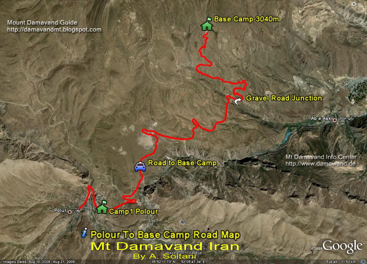
Camp1 to Camp2
Gravel Road, by car in summer or walk in winter.
Download and View The Original Size Image
Damavand Camp1 to Camp2 Road and Route Map
Drive the Gravel Road by car in summer or walk and on ski in winter
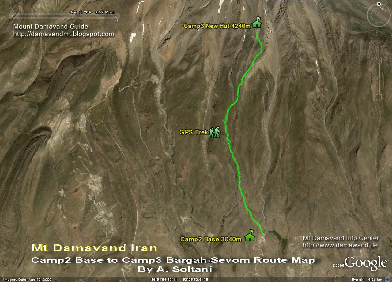
Camp2 to Camp3
Track Camp2 Base to Camp3 Bargah Sevom Old Shelter and the New Hut.
Download and View The Original Size Image
Damavand Camp2 to Camp3 Route Map
Trekking Mount Damavand Iran
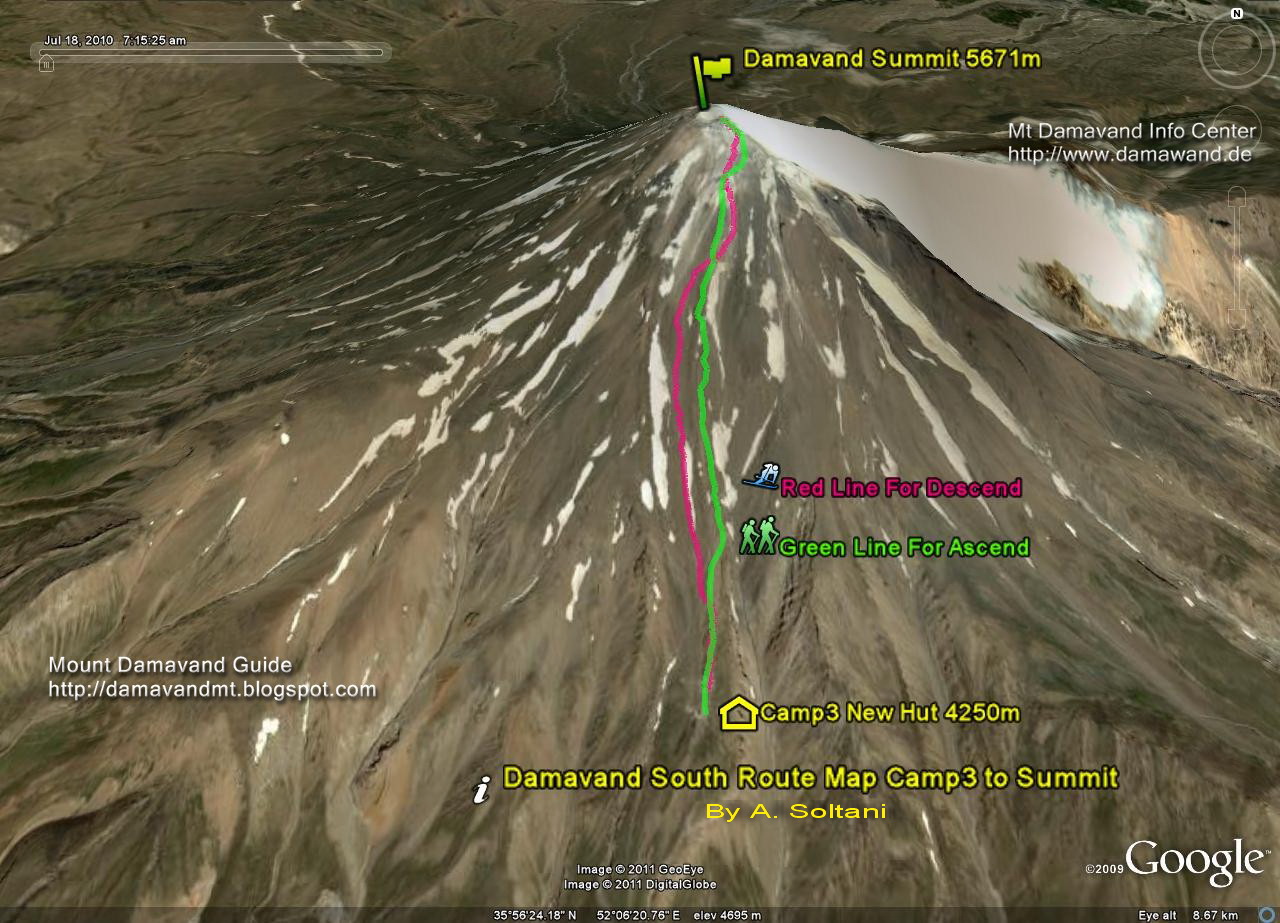
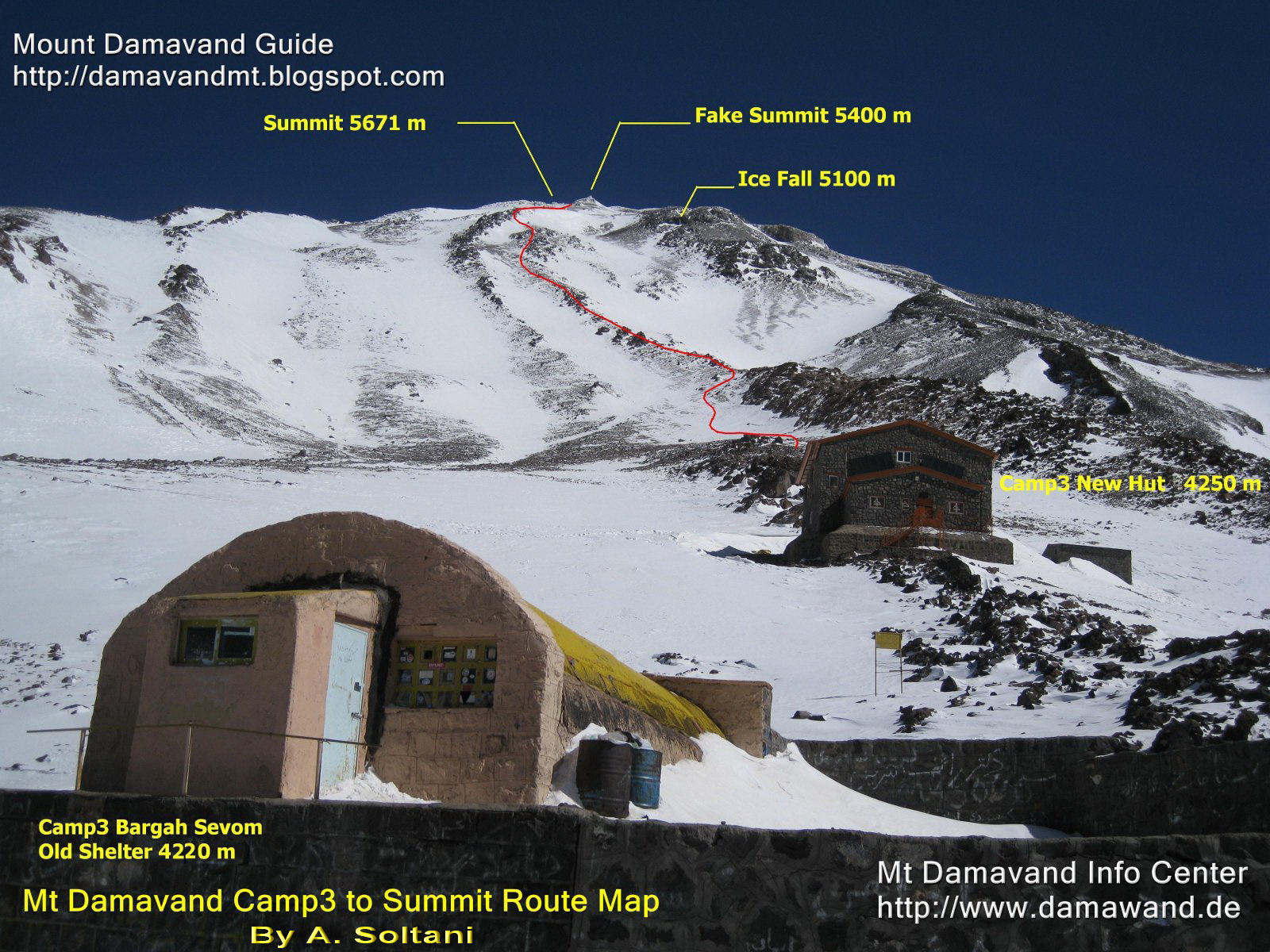
Camp3 to Summit
From Old Shelter/Refuge or the New Hut to the peak.Green foot path is for ascend and the red trail is suitable for descend.

Download and View The Original Size Image
Damavand Camp3 Bargah Sevom to the Summit Route Map
Green line for ascend from Old Shelter or New Hut to the top
Red line for descend or ski from Mt Damavand peak to Camp3
By A. Soltani
Camp3 to Summit

Download and View The Original Size Image
Mt Damavand Camp3 Shelter/New Hut to Summit Route Map
Photo By Ardeshir Soltani, Mount Damavand Guide
Difficulty and Statics

Download and View The Original Size Image
Mount Damawand Iran Difficulty and Statics
Trekking Tour Mount Damavand
IKA Airport Tehran to Camp1

Download and View The Original Size Image
IKA Airport Tehran to Damawand Camp1 Polour Road Map
Damavand Mountain Ski Touring
Tehran to Mt Damavand Road Map

Tehran International Airports to Damawand Road Map

Mt Damawand Iran Maps By Other Sources
Sources 1, By Simaye Kouch

Sources 2

Sources 3

Other Iran Mountain Road and Route Maps
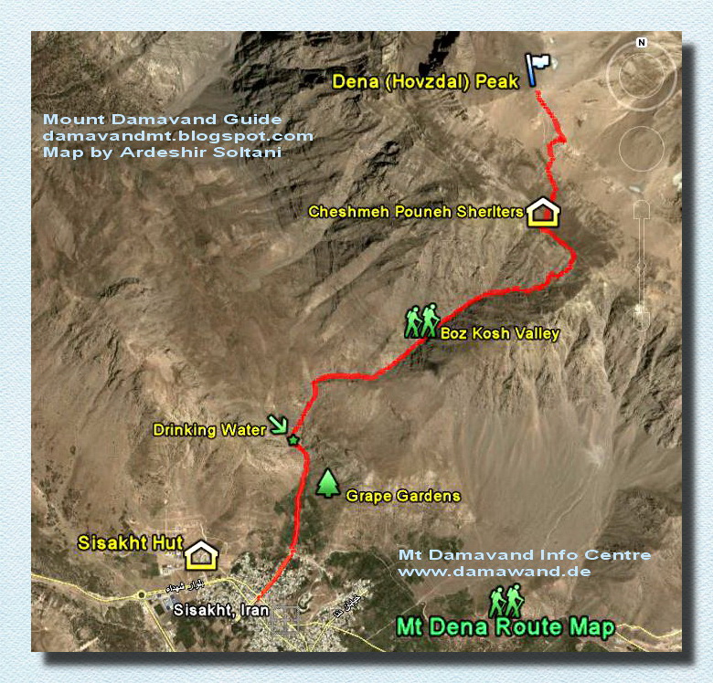
Sisakht City to Mount Dena Route Map

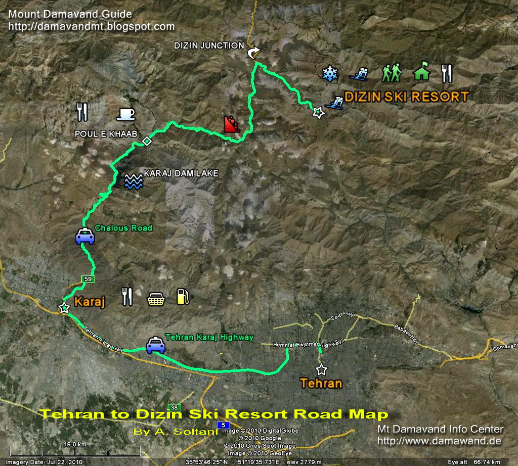
Tehran to Dizin Ski Resort Road Map

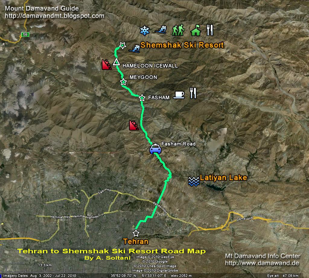
Tehran to Shemshak Ski Resort Road Map

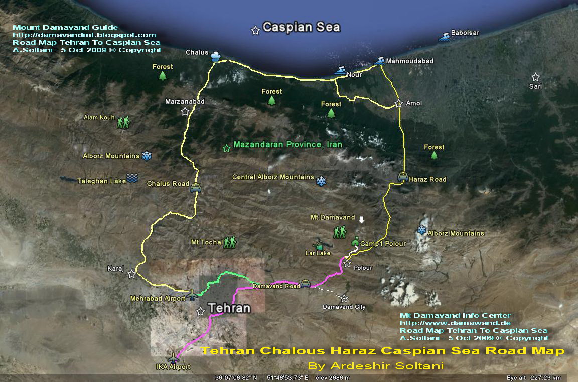
Tehran To Caspian Sea Via Haraz Road and Chalus Road

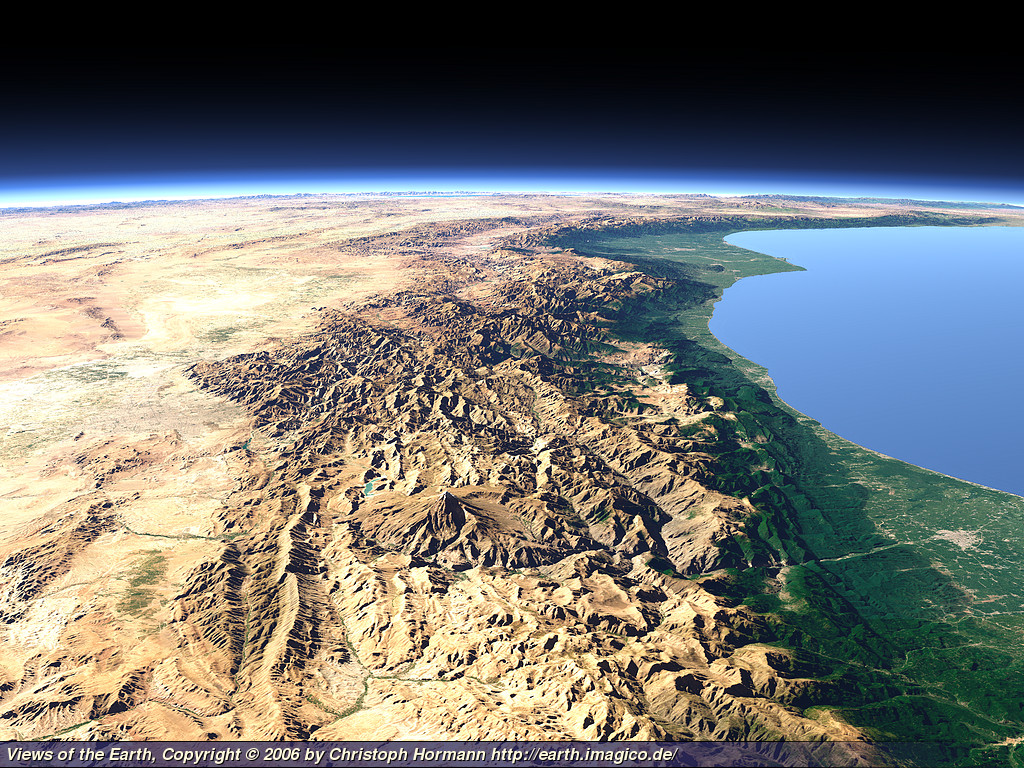
Mt Damawand in Alborz Mountain Range

Download and View The Original Size Image
Mt Damawand in Alborz Mountain Range
By Views of the Earth, Damavand Volcano, Iran
More in MDIC
Damavand Mountain Iran road and route maps. Damavand Mountain Mythology. Damawand hiking trekking and climbing maps. Source of mountain route and trail maps for outdoor activities tour. Maps for skiing and snowboarding in IranSki Resorts. Mt Damavand Iran Weather Forecast. Comprehensive information for Persia adventure travel tours to Alborz and Zageos Mountains. Hike & trek tours images. Winter sport and skitouring pictures. Alpine style mountaineering photos. Demavand Map. Budget tour to damavandiran. Damavend Route Maps, Demawand Road Map, Iran Track and Trail Maps, Iran Mountain Maps.
Damavand Maps MDIC22MAY14UM