Damavand
The Official Website of the Mount Damavand Guides Iran
- Related Topics Damavand Climbing | Damavand Ski Touring
Mount Damavand Iran
This page is redirected to: Mount Damavand, IranDamavand is a well-shaped volcano. Due to its conical shape is possible to climb it from many sides. There are about 16 known Routes to the peak with different difficulties, some very difficult and require rock climbing techniques. But 4 climbing paths are well-known because there are good shelters or suitable campsites midway.
This page is the recommended page you might like for more data Best Damavand Tour.
On the south route of Damavand Mountain there is a frozen Waterfall (or icefall) called Abshar Yakhi. This icyfall it is about 12 m tall and situated the elevation of 5100 masl, it is the highest fall in Iran and the Middle East.
There is also a small glacier in the volcano crater which is accumulated with snow and ice, usually frozen during the year. Due to freezing temperature at the summit there is little chance to see water, only in a hot summer it could melt and form a small pool. Climbing Mount Damavand.

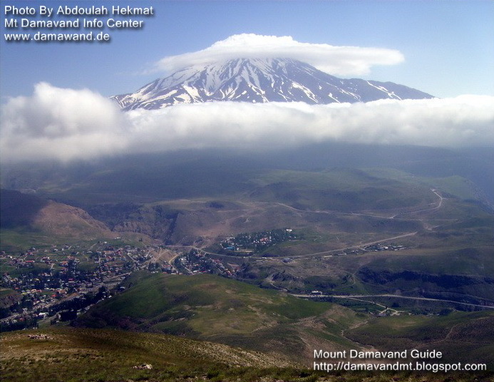
Mount Damavand Iran
View from Nava Village
Photo by Abdoulah Hekmat
Popular Route
The most popular side for Damavand Trekking Tour is South Route. It is the recommended trail for trekking tours. The starting point is Polour village and overnight at the major settlement at third campsite called Camp 3 Bargah Sevom or the New Hut at 4250 masl (13940 ft). This mountain resort was constructed in 2008 by Iranian Mountaineering & Sport Climbing Federation.This side has easy access from Tehran and North of Iran. The short distance from Tehran to the first camp at Polour Village make this approach the best route of Damawand Mountain. This is by far the best side and the ascent to the summit by this way is much safer.
Shortest Route
West route is the shortest side of Damawand Iran. The west route is famous for its sunset view. The starting point is Polour village and overnight at Simorgh refuge, a two floors refuge at 4200 masl (13,800 ft). The route type is basic mountaineering with moderate difficulty and climbing grade is walk-up, basic snow and cold but difficult descend. Damavand Ski Expedition.
Longest Route
North East route is the longest trail of Damavand Mountain. It takes two complete days to reach the summit. The starting point is Nandal village and overnight at Takht-e Fereydoun shelter at 4500 masl ( 14,760 ft). The route type is typical mountaineering with long trail difficulty and hard ascend with cold wind and long descend.
Difficult Route
North face of Damavand is the most Difficult route of the mountain for climbing . It has two shelter called 4000 and 5000. The route difficulty is scrambling mountaineering, steep, hard ascend, depending on season, cold and windy, snow & ice, difficult descend. Visit also Damawand FAQs.

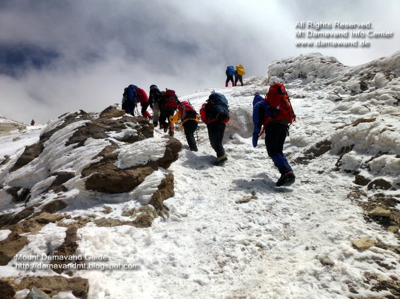
Climbing Mt Damavand Iran
Photo by Ardeshir Soltani
More in MDIC
Damavand Trekking and Climbing Tours. Damawand Summer Expedition 2015. Eco tour guide. Mountain climbing guide. Ski touring Alburz Mountains. Winter sport and skitour. Travel tour Iran. Tourist attraction sites. Visit Iran caltural sightseeing sites. Persian cultural and historical tours. Outdoor trekking tours. Shiraz Perspolis travel tour. Visit natural attractions of Persia. Ski and snowboard tour organizer to Iran ski resorts. Visit also Damavand Weather.Damavand Route. Basic facts for going up Demavand Volcano. Difficulty and climbing grade Demawand. Guided hiking & trekking adventure tours iran. Ski mountaineering and ski touring tehran expedition. Best season to climb and best climbing period. Suggested route and trails maps. Know Damawend before you go, what is the height of Mt Demavend, how tall is it. Climb as a beginner, Weather forecast. Why is weather important during mountain climbing.