Parvaneh Kazemi Conquered Mt Everest
The Official Website of the Mount Damavand Guides
- Related Topics
- Doug Scott
- Jaime Vinals
- 100 Damavand Club
Iranian Lady Parvaneh Kazem Conquered Mt Everest
Visit the official website of Parvaneh KazemiEverest (was already named peak xv) is usual name for Chomolungma that means "Goddess mother of the universe" or Sagarmatha. My plan for climbing Everest was in spring 2012, but not only Everest! I had plan to climb Lhotse...
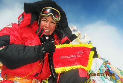
Parvaneh Kazemy
Mt Everest Summit 8848m
Everest News!
Mrs Parvaneh Kazemi after 45 days attempt managed to stand on Mt Everest Peak 8,848 meters (29,029 feet) on 18th May 2012 at 13:30 local time. This Iranian lady is the first climber in the world to summit Mount Everest in 2012 climbing season along with her favourite climbing sherpa, Nima Gyalzen from Bedin.
Our best congratulation to this great Persian female climber on behalf of Iranian climbing society.
Mount Damavand Guide Team. 19 May 2012
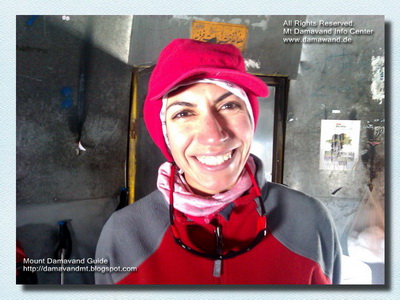
Parvaneh Kazemy
About Parvaneh Kazemi
Born: Sep 1970 Tehran, Iran.Academic Degree: University Dgree in Mathematics.
Occupation: Mathematics Teacher.
Hobby: Mountaineering, Mountain Guiding, Photography.
Club: Member of Espilat Mountaineering Club Tehran, Iran.
Mountaineering Ranks and Records
Facts and Figures about Parvaneh- First NGO Iranian lady to attempt Mt Everest independently.
- Third Persian female climber to ascend Mt Everest summit.
- First mountaineer to stand on Mt Everest Peak in 2012.
- First Iranian lady to summit Mt Manaslu, Mt Muztagata and Mt Ama Dablam.
Mountaineering Experience and Backgrounds
- Over 8000 m: Mt Manaslu (8163m) 29 April 2011 and Mt Everest (8848m) 19 May 2012.Immediately after her successful climb to Everest, in May 2012, Parvaneh is attempting her third climb to 8000 meters, Mt Lhotse 8,516 metres (27,940 ft) the fourth highest mountain on Earth (after Mount Everest, K2 and Kangchenjunga).
- Over 7000 m: Mt Muztagh Ata, or Muztagata 7,546 m (24,757 ft) in 2010
- Over 6000 m: Mt Ama Dablam 6,812 metres (22,349 ft), in 2011
10 years mountain climbing over 4000 and 5000 meters.
- Over 5000 m: Climbing Mount Damavand 5671m (many times).
- Over 4000 m: Mt Alam Kouh 4850 m, Mt Sabalan 4820 m, Mt Dena 4350 m, Iran.
- Over 3000 m: Mt Tochal 3960 m (almost every week!)
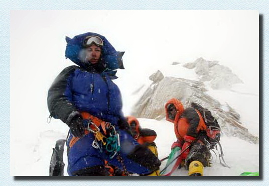
Parvaneh Kazemi
Parvaneh Kazemy Conquered Mt Lhotse
Parvaneh Kazemi Conquered Mt Lhotse immediately after her successful climb to Mt Everest. Lhotse is the third 8000 m in Parvaneh records.Mrs. Kazemi stood on Mt Lhotse peak on 25 May 2012 at 7:30 local time, along with sherpa Nima Gyalzen from Bedin, only 7 days and 18 hours after summiting Everest.
Parvaneh is the first Persian lady Hymalia mountaineer to manage two summit over 8000 meters is a single climbing season and just in one week!
Mount Lhotse 8,516 metres (27,940 ft) is the 4th highest peak on Earth (after Everest, K2 and Kangchenjunga).
Congratulation and best wishes to Parvaneh on her return.
Moun Damavand Guide Team 25 May 2012.
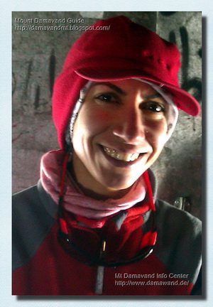
Mrs Parvane Kazemi
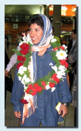
Parvaneh Kazemi
Mount Everest 8,848 metres (29,029 ft)
Everest is the earth's highest mountain. The Tibetan name is Chomolungma or Qomolangma which means "Holy Mother". It is located in the Mahalangur section of the Himalayas. The international border between China and Nepal runs across the precise summit point. Its massif includes neighboring peaks Lhotse, 8,516 m (27,940 ft); Nuptse, 7,855 m (25,771 ft); and Changtse, 7,580 m (24,870 ft).
The highest mountain on the earth attracts many well-experienced mountaineers as well as capable climbers willing to hire professional guides. While not posing substantial technical climbing challenges on the standard route, Everest presents dangers such as altitude sickness, weather and wind.
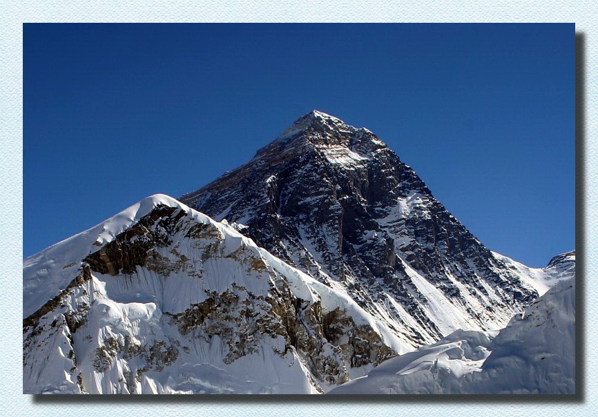
Mt Everest from Kala Patthar in Nepal
Mount Lhotse 8,516 metres (27,940 ft)
Lhotse is the fourth highest mountain on Earth (after Mount Everest, K2 and Kangchenjunga) and is connected to Everest via the South Col. In addition to the main summit at 8,516 metres (27,940 ft) above sea level, Lhotse Middle (East) is 8,414 metres (27,605 ft) and Lhotse Shar is 8,383 metres (27,503 ft). It is located at the border between Tibet (China) and the Khumbu region of Nepal.
Lhotse is best known for its proximity to Mount Everest and the fact that climbers ascending the standard route on that peak spend some time on its northwest face; see below. In fact Lhotse has the smallest topographic prominence value of any official eight-thousander, as it rises only 610 m (2,000 ft) above the South Col. Hence it is often seen as a minor eight-thousander.
However, Lhotse is a dramatic peak in its own right, due to its tremendous south face. This rises 3.2 km (2.0 mi) in only 2.25 km (1.4 mi) of horizontal distance, making it the steepest face of this size in the world. The south face has been the scene of many failed attempts, some notable fatalities, and very few ascents (one of them, by Tomo Česen, unverified).
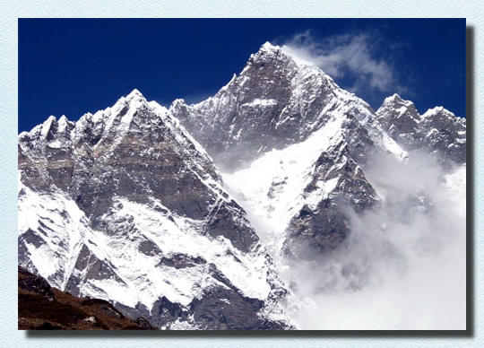
The South Face of Lhotse as seen from the climb up to Chukhung Ri
Mount Manaslu 8,156 meters (26,759 ft)
Manaslu also known as Kutang is the high peak of the Gorkha massif, and is the eighth highest mountain in the world and best climbing mountain. It is located in the Mansiri Himal, part of the Nepalese Himalayas, in the west-central part of Nepal. Its name means "Mountain of the Spirit"
Manaslu was first climbed on May 9, 1956 by Toshio Imanishi and Gyalzen Norbu, members of a Japanese expedition. It is said that "just as the British consider Everest their mountain, Manaslu has always been a Japanese mountain".Manaslu at 8,156 metres (26,759 ft) above mean sea level (m.s.l) is the highest peak in the Lamjung District and is located about forty miles east of Annapurna. The mountain's long ridges and valley glaciers offer feasible approaches from all directions, and culminate in a peak that towers steeply above its surrounding landscape, and is a dominant feature when viewed from afar.
The Manaslu region offers a variety of trekking options. The popular Manaslu trekking route of 177 kilometres (110 mi), skirts the Manaslu massif over the pass down to Annapurna. The Nepalese Government only permitted trekking of this circuit in 1991. The trekking trail follows an ancient salt-trading route along the Budhi Gandaki river. Enroute, 10 peaks over 6,500 metres (21,300 ft) are visible, including a few over 7,000 metres (23,000 ft). The highest point reached along the trek route is the Larkya La at an elevation of 5,235 metres (17,175 ft). As of May 2008, the mountain has been climbed 297 times with 53 fatalities.
Manaslu Conservation Area has been established with the primary objective of achieving conservation and sustainable management of the delimited area, which includes Manaslu.
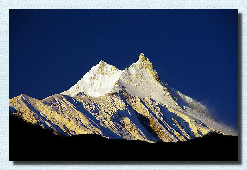
Mount Manaslu at sunrise
Mount Muztagh Ata 7,546 m (24,757 ft)
Muztagh Ata, or Muztagata ("ice-mountain-father"), is the second highest (7546 metres) of the mountains which form the northern edge of the Tibetan Plateau (not the second highest of the mountains of the Tibetan Plateau). It is sometimes regarded as being part of the Kunlun Shan, although physically it is more closely connected to the Pamirs. It is also reputedly one of the easiest 7,000 m peaks in the world to climb, due to its gentle western slope and the comparatively drier weather of Xinjiang.
Muztagh Ata lies just south of Kongur Tagh, the highest peak of the Kunlun Shan. Together they form a somewhat isolated group, separated from the main chain of the Kunlun, and also separate from the Pamir Mountains to the west. (Both peaks are sometimes regarded as being in the "Chinese Pamir", and are more closely connected to the main Pamir group than the main Kunlun group.) Not far to the north and east of this group are the lowlands of the Tarim Basin and the Taklamakan Desert. The Karakoram Highway passes very close to both peaks as well as Karakul Lake, from which the mountain is conveniently viewed. The closest city is to the mountain is Tashkurgan, the westernmost town in China and very close to the border with Pakistan.
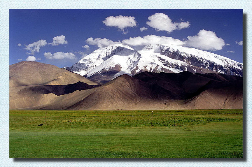
Muztagh Ata, as viewed from the Karakoram Highway
Mount Ama Dablam 6,812 m (22,349 ft)
Ama Dablam is a mountain in the Himalaya range of eastern Nepal. The main peak is 6,812 metres (22,349 ft), the lower western peak is 5,563 metres (18,251 ft). Ama Dablam means "Mother's necklace"; the long ridges on each side like the arms of a mother (ama) protecting her child, and the hanging glacier thought of as the dablam, the traditional double-pendant containing pictures of the gods, worn by Sherpa women. For several days, Ama Dablam dominates the eastern sky for anyone trekking to Mount Everest basecamp.
Ama Dablam is the third most popular Himalayan peak for permitted expeditions. The most popular route by far is the Southwest Ridge (right skyline in the photo). Climbers typically set up three camps along the ridge with camp 3 just below and to the right of the hanging glacier, the Dablam. Any ice that calves off the glacier typically goes left, away from the camp. However, a 2006 avalanche proved otherwise. A climbing permit and a liaison officer are required when attempting Ama Dablam. As with Mt. Everest, the best climbing months are April–May (before the monsoon) and September–October.
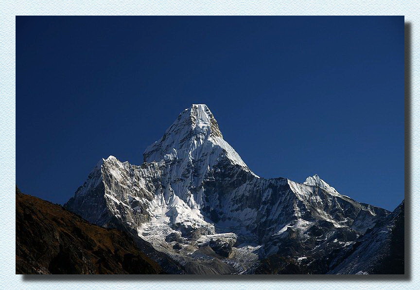
Mount Ama Dablam, The classic view from the southwest